
Facts & prices checked: 2026-06-25
| Key fact | Detail |
|---|---|
| Rift system total length | ~6,500 km (Afar Triangle to Mozambique) |
| Tanzania section | Gregory Rift (Eastern Branch), northern highlands |
| Ngorongoro Crater age | ~2.5 million years old |
| Ngorongoro Crater width | 16–19 km |
| Ngorongoro floor depth | 610 m below rim |
| Lake Natron pH | Up to 12 |
| Flamingo share at Natron | ~75% of world’s lesser flamingo population (1.5–2.5 million birds) |
| Oldoinyo Lengai | Only active natrocarbonatite volcano on Earth |
| Olduvai sediment record | 2.1 million to 15,000 years ago |
| Laetoli footprints | 3.66 million years old |
What the East African Rift Valley is
The East African Rift System is one of the most significant geological structures on Earth — not because of its age, but because it is happening right now. The African tectonic plate is splitting apart. The eastern portion of the continent is slowly separating from the rest, pulled by forces deep in the mantle that have been active for tens of millions of years. The speed is measured in millimetres per year — fast on geological time, imperceptible in a human lifetime. In 10 to 20 million years, the eastern strip of Africa will be an island.
The rift runs roughly 6,500 kilometres, from the Afar Triangle in Ethiopia — where three tectonic plates meet in the desert — south through Kenya, Tanzania, Malawi, and Mozambique. It is not a single crack but a system of interconnected rift basins, fault zones, escarpments, volcanic centres, and lake basins, each one a consequence of the continent being stretched and thinned. Where the crust stretches, it drops. The resulting topography — sheer escarpments, lake-filled basins, chains of volcanoes — is the landscape you see when you travel Tanzania’s northern circuit.
The rift has two main branches. The Western Branch runs through Uganda, Rwanda, Burundi, and the DRC, containing the world’s deepest lakes (Tanganyika, Malawi). The Eastern Branch — sometimes called the Gregory Rift — runs through Ethiopia, Kenya, and Tanzania, and is the one that shaped everything you see on a northern Tanzania safari.
Tanzania’s section: the Gregory Rift
In northern Tanzania, the Gregory Rift is responsible for a chain of features that most visitors experience without connecting: the steep escarpment you see from the Lake Manyara viewing point, the caldera landscape of the Ngorongoro highlands, the extreme soda lake of Lake Natron, the volcanic cone of Oldoinyo Lengai, and the deep sediment record of Olduvai Gorge.
The rift here runs roughly south through the highlands. The floor of the rift drops significantly below the surrounding plateau — at Lake Manyara, the rift floor is pressed between the lake and the western escarpment that rises steeply above it. The park’s narrow strip of habitat (woodland, lakeshore, and the escarpment wall) is a product of this geography. The lake itself is a soda lake — part of the same alkaline lake system as Lake Natron — and flamingos wade along its shoreline in large numbers, the same alkaline chemistry attracting them.
Further north in the rift basin sits Lake Natron, the extreme end of the soda lake spectrum — pH up to 12, no outlet, concentrating volcanic minerals for millennia. To its south, the active volcano Oldoinyo Lengai continues to add new material. The Eyasi Basin to the west is another rift feature: a lower, drier soda-saline lake system that is home to the Hadza, one of the last hunter-gatherer peoples in East Africa, whose way of life has coexisted with the central rift valley landscape for thousands of years.
The Ngorongoro highlands sit on the rift’s shoulder — not on the floor, but on the uplifted edge where volcanic activity has been most intense. The craters you see there are not random; they are the remains of a volcanic chain created by the same rift forces that produced the escarpments and basins below. The Lake Manyara National Park guide covers the park’s escarpment setting in detail, and the Tanzania flamingos guide covers Lake Natron’s breeding colony.
Ngorongoro Crater: a volcanic caldera explained
Ngorongoro is a volcanic caldera. Not a meteorite crater, not a natural bowl — a caldera, which is a specific thing: the collapsed roof of a volcano that emptied its magma chamber and caved inward.
The process is straightforward. A volcano builds up through repeated eruptions. At some point — through a catastrophic eruption or gradual drainage of the magma chamber below — the underground support disappears. Without it, the volcano’s summit has nothing to rest on. It collapses inward, producing the circular depression that now holds 25,000 large animals. This happened at Ngorongoro approximately 2.5 million years ago.
The result is the world’s largest intact, unflooded volcanic caldera. Our dedicated Ngorongoro page covers the wildlife and logistics in full. The crater is 16 to 19 kilometres wide. The floor covers approximately 260 km² and sits 610 metres below the rim. The rim itself reaches roughly 2,300 metres at its highest points. The walls are steep enough that most large animals cannot cross them, which is why the crater has evolved its own largely self-contained population — the lions, elephants, wildebeest, zebra, and rhino you see on the floor have been living in this bowl for thousands of generations.
The Ngorongoro Conservation Area contains other craters of the same volcanic origin. Empakaai, northeast of Ngorongoro, is a smaller caldera whose interior is forested and contains a deep soda lake — the only place in the NCA where you can walk down into a caldera and find flamingos at the bottom. Olmoti, to the north, is shallower, used primarily as a walking destination with montane grassland and a waterfall. Both are rarely visited relative to the main crater and both reward the detour.
Oldoinyo Lengai: the active rift volcano
Oldoinyo Lengai rises to 2,878 metres from the southern shore of Lake Natron. In Maa — the Maasai language — its name means Mountain of God. It deserves the name: it is one of the most unusual volcanoes on Earth.
Most volcanoes erupt silicate lava — the molten rock created when silica-rich continental or oceanic crust melts. Oldoinyo Lengai is the only known active volcano erupting natrocarbonatite lava. This lava is chemically closer to washing soda than to the basalt of, say, Hawaii or Etna. The differences are dramatic.
Natrocarbonatite lava erupts at roughly 500 to 600°C — cool for lava. Silicate lavas typically erupt at 700 to 1,200°C. The lower temperature means natrocarbonatite flows quickly, almost like water. When it emerges from the vent it is jet black. But expose it to moisture and CO₂ in the air and within hours it begins to pale. Within days, the black lava turns white — a bleaching process unlike anything you see at other volcanoes.
The connection to Lake Natron is direct. Oldoinyo Lengai’s eruptions over millions of years have contributed sodium carbonate minerals to the lake. The volcanic runoff does not just sit near the water — it made the water. The extreme alkalinity of Lake Natron is partly the product of what the volcano produces.
The volcano is climbable. The standard route is a night ascent starting around 1:00 a.m., aiming to reach the summit for sunrise over the rift valley. The full round trip takes 8 to 12 hours. The drive from accommodation near Ngare Sero village to the trailhead takes 30 to 60 minutes. The upper section is steep loose volcanic scree, demanding fitness and good footwear. A registered Maasai guide is required — independent climbing is not permitted. Check current volcanic conditions before you go: the crater is live, and during periods of elevated activity the summit is off-limits.
Lake Natron and the flamingo connection
The alkaline soda lakes of the East African Rift are not geological accidents — they are the product of a specific combination of factors that the rift uniquely provides: volcanic minerals dissolving into enclosed basins, high evaporation rates concentrating what cannot drain away, and no drainage outlet to dilute the accumulation.
Lake Natron is the most extreme example. Its pH reaches up to 12 — caustic enough to burn skin and eyes on contact. Most organisms cannot survive in it. But cyanobacteria — specifically spirulina — thrive at exactly these alkaline conditions, forming the dense blooms that give the lake its red and orange colour and that feed the flamingos. The same chemistry that makes the lake lethal to most animals is what makes it the only regular breeding ground for lesser flamingos in East Africa.
Since 1962, no other East African site has hosted successful large-scale lesser flamingo breeding. Roughly 75% of the world’s lesser flamingo population — between 1.5 and 2.5 million birds — breeds at Lake Natron, with up to one million nests recorded in peak breeding years. The timing follows the dry season: water levels drop to expose the caustic mudflats where the birds build mud-cone nests, placing eggs above the waterline. Lesser flamingo breeding is triggered by conditions, not the calendar — it does not happen every year, and the scale varies dramatically.
The calcification that makes Lake Natron famous in wildlife photography — animals preserved in lifelike poses coated in sodium carbonate minerals — is a consequence of the same chemistry. Animals that die in the lake or at its margins are coated by the mineral-rich water. The same material that kills them preserves them. Photographer Nick Brandt documented this in 2013 in images that became widely circulated precisely because they looked improbable and were completely real.
How the rift shaped human evolution
The East African Rift’s importance to human evolution is not a coincidence. Three features of rift geology directly created the conditions for evolution and fossil preservation that made this region central to understanding human origins.
Habitat diversity. The rift created dramatic topographic variation in a small area: rift floor wetlands at low altitude and warm temperature, highland forests on the uplifted shoulders, open grassland on the plateau. In evolutionary terms, this diversity of habitat in close proximity creates selection pressure and drives speciation. Populations isolated by escarpments and lake basins diverge. The diversity of early human lineages in East Africa reflects in part the diversity of environments the rift created.
Sediment exposure. Olduvai Gorge exists as a fossil site because of the rift. Over millions of years, the rift floor accumulated layers of volcanic ash, lake sediment, and soil — a continuous geological record. As the rift floor dropped and seasonal rivers cut down through these layers, the cross-section was exposed. Olduvai is a 48-kilometre ravine through 2.1 million years of sediment — from about 2.1 million to 15,000 years ago. The deposits have yielded more than 60 hominin fossils, including specimens of Homo habilis, one of our earliest tool-using ancestors, who occupied Olduvai approximately 1.9 million years ago. Mary and Louis Leakey spent more than 30 years here and uncovered the first well-dated evidence of some of our earliest human ancestors. The Olduvai Gorge guide covers the site, what you can see on a visit, and access from Ngorongoro.
Volcanic ash preservation. Laetoli, 45 km south of Olduvai, contains hominin footprints dating to 3.66 million years ago — some of the oldest direct evidence of bipedal walking. They were preserved not in rock but in volcanic ash from a rift eruption. The fine ash from a nearby volcano fell wet, was walked across by early hominins (and animals), dried quickly, and hardened into tuff. Subsequent ash falls buried them. The rift that drove those eruptions is directly responsible for the preservation of evidence that rewrote our understanding of when our ancestors began walking upright.
Standing on the Manyara escarpment
The first time I understood I was in a rift valley was standing at the top of the escarpment above Lake Manyara at dusk. The park is below — the strip of woodland between the cliff wall and the lake. From up there, the lake is 25 to 30 km away, but the pink edge of the flamingo concentrations was visible even at that distance. The birds looked like a smear of paint along the far shore.
I was standing on the wall of a tear in the African continent. The escarpment is not just a cliff — it is the edge of a fault block, the surface expression of a crack that runs deep into the earth. The floor of the rift is lower because the crust between these faults has dropped. What I was looking at was the exposed edge of that drop.
In 10 million years this will be an ocean. The rift will have widened and deepened enough that seawater will flood in from the south, separating eastern Africa as an island. The lake floor will be the seafloor. The escarpment I was standing on will be a coastline.
That is what Tanzania’s northern circuit is: geology in the middle of happening.
<RelatedReads items={[ { label: “Ngorongoro Crater complete guide”, url: “/en/tanzania/ngorongoro/” }, { label: “Tanzania flamingos and Lake Natron”, url: “/en/tanzania/flamingos/” }, { label: “Olduvai Gorge guide”, url: “/en/tanzania/olduvai/” }, { label: “Lake Manyara National Park”, url: “/en/tanzania/lake-manyara/” }, { label: “Tanzania northern circuit overview”, url: “/en/tanzania/northern-circuit/” }, ]} />
Frequently asked questions
What is the East African Rift Valley?
The East African Rift System is a zone where the African tectonic plate is slowly splitting apart — the continent is physically pulling apart at a few millimetres per year, running from the Afar Triangle in Ethiopia south through Kenya, Tanzania, Malawi, and Mozambique for about 6,500 km. In 10–20 million years, the eastern portion of Africa will separate entirely. In Tanzania, the Eastern Branch (called the Gregory Rift) passes through the northern highlands, creating the dramatic escarpment above Lake Manyara, the volcanic calderas of the Ngorongoro highlands, the extreme soda lake basin of Lake Natron, and the sediment layers that exposed the Olduvai Gorge fossil record.
Is Ngorongoro Crater caused by a meteorite?
No. Ngorongoro is a volcanic caldera — the collapsed remains of a volcano that emptied its magma chamber and collapsed inward approximately 2.5 million years ago. The crater is 16 to 19 kilometres wide and the floor sits 610 metres below the rim, covering about 260 km². The crater's isolation (the rim is high enough that most animals cannot easily leave) is what gives it the extraordinary wildlife density. The Ngorongoro Conservation Area contains other volcanic craters of the same origin: Olmoti, Empakaai, and Loolmalasin are all part of the same rift-driven volcanic landscape.
Why does Lake Natron have so many flamingos?
Lake Natron is an alkaline soda lake — very high pH (up to 12), high sodium, high evaporation rate, no drainage outlet. This chemistry, fed by volcanic minerals from Oldoinyo Lengai and the wider Gregory Rift, creates conditions lethal to most animals but ideal for the cyanobacteria that lesser flamingos eat. The alkalinity that makes the lake dangerous (animals that die in it can be calcified by mineral deposits) is what makes it the world's largest lesser flamingo breeding colony — roughly 75% of the global population, between 1.5 and 2.5 million birds. Since 1962, no other site in East Africa has hosted large-scale lesser flamingo breeding.
What is Oldoinyo Lengai and can I climb it?
Oldoinyo Lengai ('Mountain of God' in Maa, the Maasai language) is an active volcano in the Gregory Rift on the southern shore of Lake Natron, and the only known active volcano on Earth erupting natrocarbonatite lava. The lava is jet black when it flows and turns white within days as it absorbs moisture and CO₂. The volcano can be climbed via night ascent — departure is typically around 1:00 a.m. to reach the summit for sunrise; the full round trip takes 8 to 12 hours. The drive from accommodation near Ngare Sero village to the base takes 30 to 60 minutes. A registered Maasai guide is required; independent climbing is not permitted. Check current volcanic conditions before going: the summit crater is a live environment.
Why did human evolution happen in the East African Rift?
The rift's geological activity created unusual conditions for evolution: diverse habitats in close proximity (rift floor wetlands, highland forest, open grassland) created selection pressure for adaptable species; geological subsidence exposed ancient lake and volcanic sediment layers making fossil preservation and discovery possible; and periodic climate shifts within the rift drove physiological adaptation. Olduvai Gorge exists specifically because the rift floor dropped and rivers cut down through 2.1 million years of accumulated volcanic and lake sediment — exposing a cross-section of human prehistory that would otherwise be buried. Laetoli's 3.66 million-year-old footprints were preserved in volcanic ash from a rift eruption.
Can I see the rift valley escarpment in Tanzania?
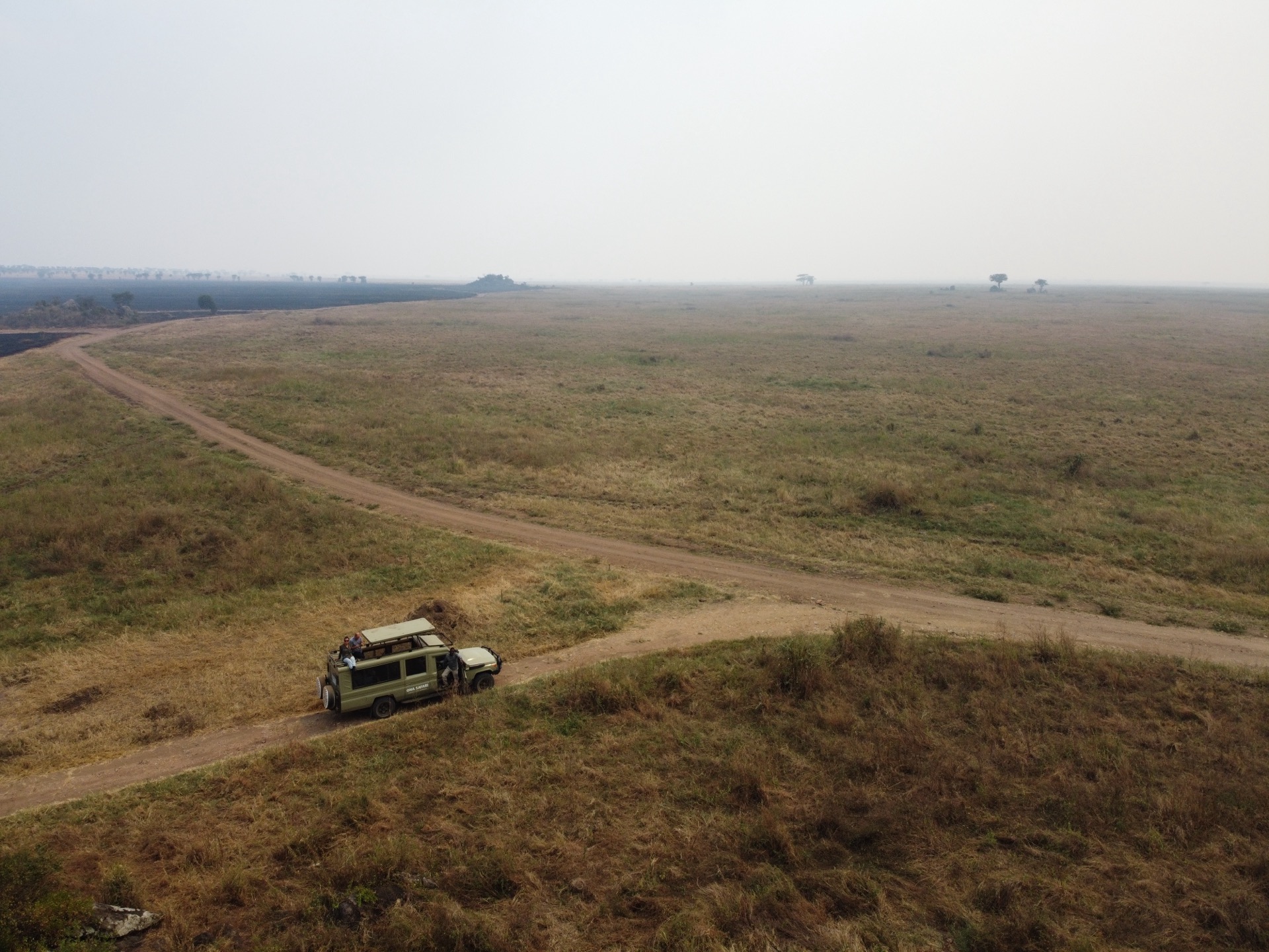
Yes — dramatically. The drive from Arusha toward Lake Manyara follows the top of the rift escarpment before descending to the park entrance. The view from the escarpment top — looking down into the rift floor with the lake in the distance — is one of the most geologically striking sights in Tanzania. Inside the park, the escarpment reads as a green cliff wall rising above the woodland and lake. Empakaai Crater in the Ngorongoro highlands is also accessible for hiking and contains a soda lake inside the caldera — the closest most visitors get to experiencing a caldera interior on foot.