
Facts & prices checked: 2026-06-25
In two to six days of walking, Kilimanjaro takes you from tropical rainforest to permanent arctic ice — a vertical journey that would require travelling from the equator to the polar regions if done horizontally. No other mountain in the world compresses quite so many distinct ecosystems into a single accessible walk.
Kilimanjaro is not a technical climb. No ropes, no crampons, no glacier training. What it is, is a passage through five completely different worlds. Understanding those worlds — what lives in each, what temperature to expect, what the air feels like, what the land looks like — is one of the most useful things a climber can know before they start.
Why the zones matter for everyone who climbs
Kilimanjaro sits at approximately 3° south of the equator. Its position creates a unique interaction between tropical heat, high altitude, and the Indian Ocean weather systems that drive rain up the southern slopes. The result is a mountain where a vertical kilometre of climbing produces more ecological change than most horizontal journeys of a hundred kilometres in temperate regions.
The zones matter for three practical reasons.
Gear. You need completely different clothing at 1,800 m (warm, wet, humid forest) versus 5,000 m (arctic cold, dry, UV-intense). Everything you carry on summit night you have already been carrying since the gate. The zones tell you why the packing list for Kilimanjaro is as long as it is.
Acclimatisation. The altitude effects begin meaningfully in Zone 3 (around 2,800–3,000 m) and become dominant in Zone 4. Knowing which zone you are in tells you which symptoms are normal, which are warning signs, and when to start taking altitude seriously.
Experience. The five zones are five completely different visual and physical experiences. Climbers who understand what they are walking into are better prepared for the transitions — particularly the sudden, striking change from enclosed rainforest to open moorland, and the much lonelier, more demanding passage through the alpine desert above 4,000 m.
Zone 1 and Zone 2: Cultivation and Montane Forest (800–2,800 m)
Zone 1 — Cultivation (800–1,800 m) covers the lower slopes below the national park boundary. This is the most densely settled zone on Kilimanjaro — small farms, banana gardens, market villages, and coffee plantations. The soil here is volcanic and exceptionally fertile. The regional climate is warm and humid, typically 20–30°C by day.
Most trekkers arrive by vehicle through this zone rather than on foot. The park gates — Machame Gate at 1,800 m, Marangu Gate at 1,860 m — mark the transition to national park territory and Zone 2.
Zone 2 — Montane Forest (1,800–2,800 m) is the most biodiverse zone on the mountain and visually one of the most spectacular. The forest is dense, wet, and old-growth in character. The southern slopes, which catch the Indian Ocean rain shadow, receive 2,000–3,000 mm of rainfall per year — more than most equatorial forests. The northern slopes are drier, which is why the Rongai route (approaching from the north) starts in different, more open vegetation than the southern routes.
What you will see:
- African olive trees (Olea europaea subsp. africana), Podocarpus (yellowwood), Prunus africana, and fig trees form the canopy
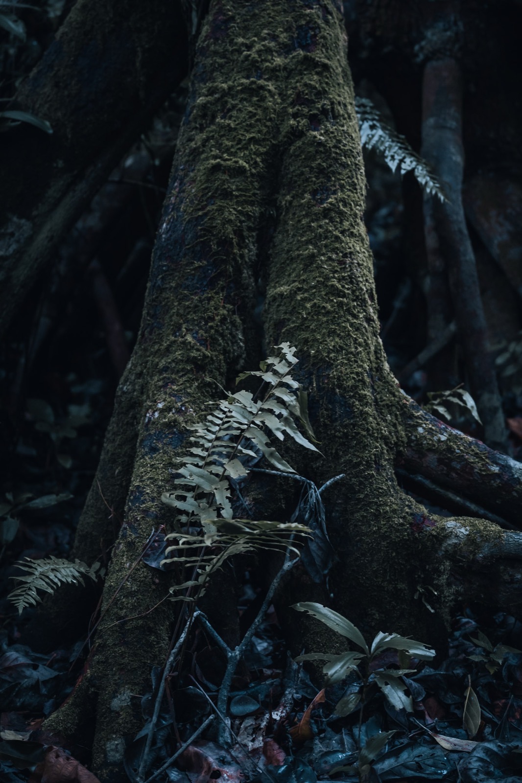
- Mosses, lichens, and tree ferns fill the understorey — in places the forest floor is completely carpeted
- Black-and-white Colobus monkeys (Colobus guereza) are the signature forest species. They move through the upper canopy and can sometimes be heard crashing through branches before they are seen. The all-black body with white mantle and flowing white tail is unmistakable
- Blue monkeys (Cercopithecus mitis) are present in smaller numbers at lower elevations
- Hartlaub’s turaco is the most vivid forest bird — identified by the flash of crimson underwing when it flies. Hartlaub’s has a reliable nesting site near the first-day lunch stop on the Machame route
- Elephant, buffalo, and leopard move through the forest zone and occasionally cross paths with trekkers, but sightings are rare. The primary wildlife experience in the forest is primates and birds
Temperature: 12–18°C by day at the upper end of the zone; cooler in the understorey and at night. Rain is frequent even in the dry seasons — rain gear is essential from the first day on Machame, Lemosho, and Rongai.
First camps: Mandara Huts (Marangu route) at 2,720 m; first camp on Machame at approximately 3,000 m (which puts you just above the forest line by the first night).
Trail conditions: Mud is the primary challenge, particularly on the southern routes after rain. Tree roots cross the path constantly. Trekking poles are useful for balance in the forest even before the altitude makes them essential.
Zone 3: Heath and Moorland (2,800–4,000 m)
Leaving the forest is one of the defining moments of any Kilimanjaro route. The trees thin, the trail rises above the canopy, and suddenly you are in a completely different landscape: open, wind-exposed, visually dramatic.
Zone 3 runs from approximately 2,800 m to 4,000 m and has two distinct sub-zones.
Heath (2,800–3,500 m): The lower moorland is defined by giant heather — Erica arborea growing to 10 metres or more in height. Tree-sized heather is a genuinely unusual sight; in most of the world, heather is a ground-covering shrub. On Kilimanjaro’s upper forest edge, it grows into small forests of its own. Combined with Spanish moss hanging from the branches and thick mist, the effect is otherworldly.
Moorland (3,500–4,000 m): Above the heather zone, the landscape opens into moorland proper — tussock grass (Festuca pilgeri), Alchemilla (lady’s mantle forming low cushions over the ground), and the first appearance of Giant Senecio groundsels. The Shira Plateau — crossed on the Machame and Lemosho routes at around 3,840 m — is a classic moorland environment with wide views and real exposure.
What you will see:
- The giant heather forest at the forest-moorland transition: dense, gnarled, moss-draped
- First Giant Senecio specimens appearing at around 3,300–3,500 m — widely spaced at first, becoming more frequent higher up
- White-necked raven is the most reliable bird in this zone — found in small groups, bold around campsites
- Augur buzzard circling the open moorland updrafts
- 4-striped grass mouse — the small mammal most commonly seen in the moorland, foraging at camp
Temperature: 5–15°C by day in good conditions; wind drops the effective temperature significantly. Night temperatures fall near or below freezing, particularly above 3,500 m. The transition out of the forest removes the wind shelter that the canopy provides.
Key camps: Horombo Huts (Marangu route) at 3,720 m; Shira Camp (Machame/Lemosho) at 3,840 m. From Shira, the summit is visible for the first time on many routes — a long, smooth dome of snow that looks much closer than it is.
Acclimatisation: AMS (Acute Mountain Sickness) begins to appear in some climbers in the upper moorland zone. Headache, fatigue, and poor sleep are the most common symptoms above 3,000 m. The “climb high, sleep low” principle — traversing to a higher point during the day and descending slightly to camp — applies here. Machame’s route to the Lava Tower (4,642 m) and back to Barranco Camp (3,900 m) is the classic example.
Zone 4: Alpine Desert (4,000–5,000 m)
Above the moorland, the vegetation becomes sparse to the point of near-absence. Zone 4 is the alpine desert — a high-altitude environment of cold temperatures, intense UV radiation, freeze-thaw rock cycles, and almost nothing alive.
What you will see (and won’t see):
- Giant Senecio tazzetii and other Dendrosenecio species reach their peak presence and size in the lower alpine desert. These are prehistoric-looking plants — see the dedicated section below for more detail
- Giant Lobelia deckenii (and related species) forms its distinctive ground-level rosettes here, occasionally shooting up a tall flower spike that blooms once in the plant’s life and then dies
- Some mosses and lichens on rock surfaces. Essentially no grass
- Almost no fauna. The white-necked raven reaches the lower alpine desert zone. Occasional bird of prey on thermals. Above 4,500 m, animal life becomes essentially absent
Temperature: 0–10°C by day with direct sun; the UV intensity is extreme at this elevation and the thin atmosphere offers little protection. Night temperatures drop well below freezing — Barafu Camp (4,673 m) commonly reaches −5°C to −10°C at night even in the warmest months.
The freeze-thaw environment: The combination of intense daytime sun and well-below-freezing nights creates constant freeze-thaw cycling in the rock surfaces. This mechanically breaks down the volcanic scree that covers much of the trail above 4,500 m. It also means that any exposed liquid water — in a water bottle, in your boots, in energy gels — will freeze on summit night.
Key camps: Barafu Camp (Machame/Lemosho routes) at 4,673 m is the standard summit departure point. School Hut (alternate summit camp) at approximately 4,710 m. Kibo Huts (the Marangu route) at 4,700 m — the only Kilimanjaro camps that are permanent buildings rather than tent sites.
The altitude challenge: Zone 4 is where the cumulative physical toll of altitude becomes dominant. At 4,700 m, atmospheric oxygen concentration is roughly 55–60% of sea level. Physical performance is measurably impaired even for acclimatised climbers — the familiar feeling of walking at sea level simply does not exist here. Summit attempts begin from Barafu or Kibo Huts around midnight, after a few hours of attempted sleep (most climbers do not sleep well at this altitude).
Zone 5: The Arctic Summit (5,000–5,895 m)
Above approximately 5,000 m, Kilimanjaro is an arctic environment. Nothing grows. No animal lives here permanently. The zone is defined by rock, volcanic scree, and ice — and increasingly, by the absence of ice that was once here.
The summit crater and geography:
- Kibo is the central and highest of Kilimanjaro’s three volcanic cones. The rim of the Kibo crater is what most routes aim for
- Stella Point (5,756 m) is where most routes crest the crater rim. TANAPA accepts Stella as a valid summit certification, but most climbers continue across the crater to Uhuru
- Uhuru Peak (5,895 m) is the true summit — the highest point in Africa. It sits on the southern rim of the Kibo crater
- Reusch Crater is the inner crater at approximately 5,750 m, a concentric depression within the Kibo crater. The Ash Pit sits inside Reusch Crater at a depth of 350 m and a width of 140 m. It emits steam and volcanic gases with a strong sulfur odour. Visiting requires a special park permit separate from the standard summit certificate and is not included in standard guided climbs
The glaciers:
The glaciers are the most photogenic and most alarming feature of the summit zone. The remaining ice fields include the Furtwängler Glacier — the largest single remaining glacier on Kilimanjaro, measured at approximately 10,400 square metres in a 2023 satellite estimate, down from around 11,000 square metres in 2018. The Northern Ice Field — the most extensive remaining ice mass — has persisted for at least 11,700 years according to ice core dating, surviving multiple drought periods including one approximately 4,200 years ago. It is now losing mass at a pace unprecedented in that 11,700-year record.
What this means for a climber visiting today: the glaciers are visible and dramatic. The vertical ice walls of the Northern Ice Field catch the headlamp light on summit night and reflect it back in blue-white. But they are smaller than in any historical photograph you have seen. Ernest Hemingway described “the snows of Kilimanjaro” in 1936; the glaciers visible in photographs from that era are considerably larger than what exists today. Multiple scientific projections suggest the remaining ice could be entirely gone within a few decades.
A summit attempt now is one of the last opportunities to see glacier ice on Kilimanjaro.
Summit conditions:
- Temperature on summit night: −10°C to −20°C with wind chill as the standard range at Uhuru
- Wind is the primary physical hazard — even moderate wind at −10°C creates significant heat loss through any exposed skin
- Oxygen at the summit is approximately 50% of sea level concentration — each breath delivers half the oxygen a breath delivers at the coast
- Ravens have been observed on the crater rim but are rare above 4,500 m and have no permanent presence at the summit
The summit push:
The ascent from Barafu (4,673 m) to Uhuru (5,895 m) gains 1,222 m of altitude in one continuous push — typically 5–8 hours up, 3–5 hours down. Beginning around midnight, passing through the coldest pre-dawn hours, moving through darkness and thin air to reach the summit at or around sunrise is the standard experience. Most turnarounds happen between 5,000 m and Stella Point; the zone between Stella (5,756 m) and Uhuru across the crater rim is the final 30–45 minutes after an already full night of climbing.
Giant Senecio and Giant Lobelia: the signature plants
No image from a Kilimanjaro climb is more striking than a field of Giant Senecio against the backdrop of Kibo’s glaciated dome. These plants are among the reasons Kilimanjaro’s upper zones are genuinely unlike anywhere else on Earth.
Giant Senecio (Dendrosenecio kilimanjari and related species):
These plants look like nothing in temperate landscapes. A thick trunk, often 2–4 metres tall, is topped by a dense rosette of large, succulent-edged leaves arranged around the growing tip. The overall impression is somewhere between a prehistoric palm tree and a giant succulent. They grow approximately 1 cm per year. A specimen 3 metres tall may have started growing around 300 years ago — during the same period that European colonisation of the Americas was underway.
The trunk has a crucial adaptation: it is hollow, and the hollow interior traps warm air from the day. This acts as a passive thermal buffer overnight, keeping the core of the plant several degrees warmer than the ambient temperature during freeze-thaw cycles. Without this mechanism, the growing tip would be killed by the nightly freeze.
Giant Senecio are found on several East African high-altitude volcanoes — Kilimanjaro, Mount Kenya, the Rwenzori Mountains, Mount Elgon — but nowhere else in the world. They are a remnant of an ancient alpine flora that evolved in isolation on these peaks over millions of years.
Giant Lobelia (Lobelia deckenii and related species):
The Giant Lobelia forms a dense, ground-hugging rosette of leaves in the lower alpine desert zone. It is monocarpic — it blooms once in its life, sending up a tall spike of flowers, then dies. The timing of that single bloom is not predictable by age; individual plants can live for decades before flowering. The flower spike can reach 3 metres or more, creating a striking visual presence before the plant’s death.
Like the Giant Senecio, Giant Lobelia have a thermal adaptation: the rosette closes slightly at night, trapping air around the growing tip and reducing heat loss. The leaves also have fine hairs that create a boundary layer of insulating air.
What to pack for each zone
Kilimanjaro packing is really about managing transitions between these five zones in a single bag. The full gear list covers the complete kit, but here is the zone-by-zone logic:
Forest zone (Zone 2): Rain jacket on. Lightweight hiking layers. Trekking poles optional but useful for roots and mud. Water from streams or camp.
Moorland zone (Zone 3): Wind layer goes on when you exit the forest. Temperature drops 5–8°C with the wind exposure. A fleece mid-layer adds warmth at camp. Sunglasses begin to matter — UV intensity increases with altitude.
Alpine desert (Zone 4): Full insulation out. Down jacket for camp and summit departure. Insulating trousers or double layer on the legs. Gloves become essential, not optional. Water bottles should be kept inside the sleeping bag at night to prevent freezing.
Summit zone (Zone 5): Full cold-weather system. The stack for summit night: merino base layer (top and bottoms) → fleece → down jacket → hardshell jacket → insulating trousers → hardshell trousers → balaclava → insulated hat → liner gloves → insulated mittens → gaiters over boots. An insulated water bottle or thermos prevents water from freezing. Hand warmers inside mittens. Headlamp with fresh batteries (cold drains them faster than expected).
The moment the forest breaks
The first time I walked out of the rainforest zone on Kilimanjaro — coming through the last trees onto open heath at around 2,800 m — I felt the change before I processed it consciously. The temperature dropped. The air pressure on sound changed; suddenly there was wind, coming from the northwest, with nothing to stop it. The light changed too: brighter, cleaner, less filtered by canopy.
Then I turned and looked upward. After two days inside the forest I had been unable to see more than 30 metres ahead. Now, from the moorland, the whole mountain was visible — Kibo’s enormous dome, still about 3,000 vertical metres above me, white with snow and cloud, the caldera rim just distinguishable through the haze.
That moment — the forest clearing, the view opening, the summit appearing at its true scale — is the moment most climbers describe as the point they understood what they had signed up for. The forest protects you from that knowledge for the first day or two. The moorland takes it away.
For altitude sickness symptoms, Diamox use, and the medical protocol on summit night, see the full altitude sickness breakdown. For the full route comparison — Machame, Lemosho, Marangu, Rongai, and the Northern Circuit — see the route-by-route comparison. For the best seasons to climb, including which months offer the clearest summit views, see the seasonal timing guide. The full packing list, including what works at each zone transition, is in the zone-by-zone packing breakdown.
Frequently asked questions
What vegetation zones does Kilimanjaro have?
Kilimanjaro has five distinct vegetation and climate zones from base to summit. Zone 1 (Cultivation, 800–1,800 m): farms, coffee, bananas on the lower slopes outside the park. Zone 2 (Montane Forest, 1,800–2,800 m): dense rainforest with Colobus monkeys, forest birds, occasional elephant and buffalo; southern slopes receive 2,000–3,000 mm rain per year. Zone 3 (Heath and Moorland, 2,800–4,000 m): giant heather trees up to 10 m, open moorland, Giant Senecio groundsels beginning to appear, first serious altitude effects. Zone 4 (Alpine Desert, 4,000–5,000 m): near-lifeless; Giant Senecio and Giant Lobelia; Barafu Camp (4,673 m) for summit attempts. Zone 5 (Arctic Summit, 5,000–5,895 m): rock, ice, retreating glaciers, no plant life.
What is the weather like in Kilimanjaro's different zones?
Weather changes dramatically with altitude on Kilimanjaro. The forest zone (1,800–2,800 m) is warm and frequently rainy — expect 12–18°C by day with regular mist and rain; the southern slopes receive 2,000–3,000 mm annually. The moorland zone (2,800–4,000 m) is cooler with wind exposure — 5–15°C by day, near freezing or below at night. The alpine desert (4,000–5,000 m) has extreme diurnal range: intense daytime UV with temperatures of 0–10°C, dropping well below freezing at night. The summit zone sees −10 to −20°C with wind chill on summit night. Pack in layers that cover every zone — you will use different combinations at different elevations and times of day.
What wildlife can you see on Kilimanjaro?
Wildlife is concentrated in the montane forest zone (1,800–2,800 m). Black-and-white Colobus monkeys (Colobus guereza) are commonly seen, often in family groups in the canopy. Blue monkeys (Cercopithecus mitis) are also present. Forest bird diversity is high — Hartlaub's turaco, multiple sunbird species, Silvery-cheeked hornbill. Elephant, buffalo, and leopard use the forest zone but are rarely seen by trekkers. Above the forest, wildlife drops off sharply. White-necked ravens are the most reliable animal through the moorland and alpine desert. The summit zone has essentially no resident fauna.
What are Giant Senecio plants on Kilimanjaro?
Giant Senecio (giant groundsel, Dendrosenecio kilimanjari) are one of the most remarkable plants in the Kilimanjaro ecosystem. They grow as tree-like plants with a thick trunk topped by a rosette of large succulent leaves — resembling a prehistoric palm crossed with a succulent. They grow approximately 1 cm per year, meaning a specimen 3 metres tall may be around 300 years old. The hollow trunk traps warm air overnight, protecting the growing tip from freeze damage. Giant Senecio are found on several East African high-altitude volcanoes — Kilimanjaro, Mount Kenya, Mount Elgon — but not anywhere else in the world.
Are Kilimanjaro's glaciers disappearing?
Yes. The Kilimanjaro glaciers have been retreating measurably since the late 19th century and the pace has accelerated. The Furtwängler Glacier — the largest remaining — covered approximately 10,400 square metres by 2023, down from earlier estimates of 11,000 square metres in 2018. The Northern Ice Field has persisted for at least 11,700 years but is now losing mass rapidly. Scientific projections suggest the remaining ice could disappear entirely within decades. A summit attempt today is one of the last opportunities to see glacier ice on Kilimanjaro.
What zone do most people find hardest on Kilimanjaro?
The transition from the alpine desert (Zone 4) into the arctic summit (Zone 5) on summit night is what most climbers describe as the defining challenge. The departure from Barafu Camp (4,673 m) at around midnight for Uhuru Peak (5,895 m) involves gaining 1,222 m of altitude in darkness, cold, and at severely oxygen-depleted elevation. The combination of extreme altitude, temperatures of −10 to −20°C with wind chill, sleep deprivation, and cumulative physical fatigue makes this the hardest section. Most turnarounds happen between 5,000 m and Stella Point (5,756 m) — the final push from Stella across the crater rim to Uhuru is the last section.